Monte Cimas Avenue
Property details
Location
View on broker sites
Neighborhood Context
Nearest freeway: Redwood Highway (2.5 mi)
Aerial Description
The property is situated on a sloping lot, appearing larger than immediately adjacent neighboring properties which are also surrounded by dense vegetation. To the north, the property is bordered by a gravel driveway and other residential structures, while to the east and south, it backs onto an undeveloped, tree-covered hillside. The backyard features a prominent swimming pool, paved patio areas, and significant landscaping with mature trees. The lot is accessed by a winding street that appears to be a through street rather than a cul-de-sac, with the neighborhood having a moderately spaced density.
Image Descriptions (8)
This aerial view shows the subject property, outlined in yellow, situated on a hillside characterized by numerous residential homes and distinct property lines. The natural landscape is predominantly covered in trees and appears to have varying elevations.
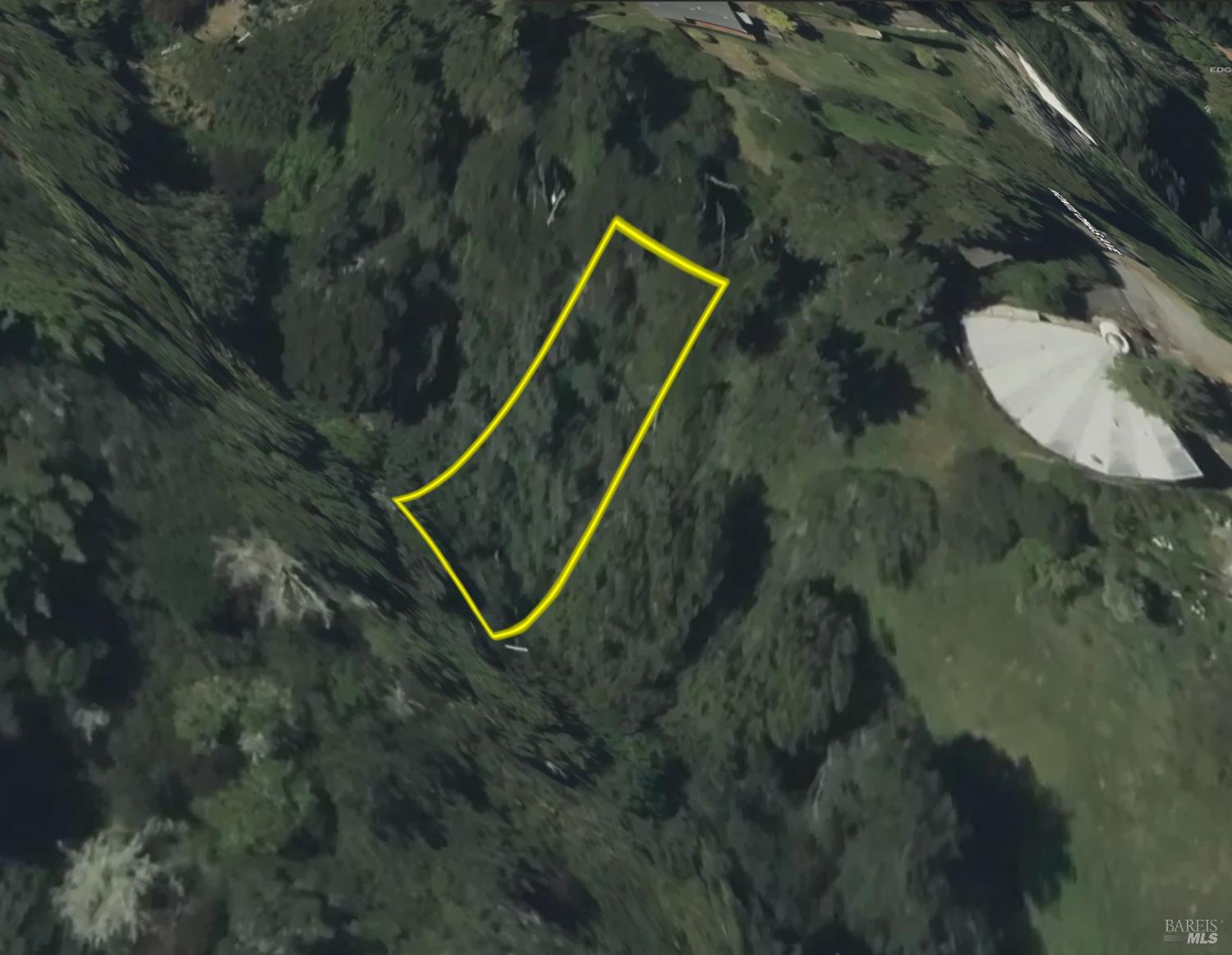
This aerial view shows a wooded parcel of land outlined in yellow, situated on a steep, natural slope. The surrounding terrain is characterized by dense foliage and undulations in the earth.
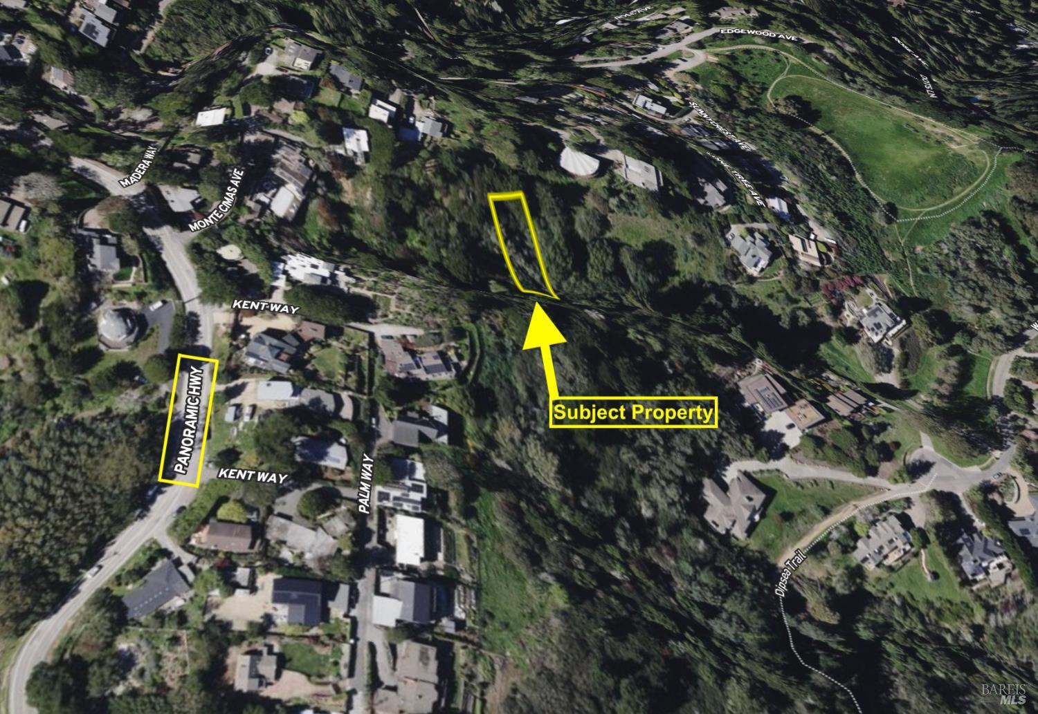
This aerial perspective highlights the subject property, outlined in yellow, nestled within a hillside community with numerous residential structures visible. Roadways such as Panoramic Highway and Kent Way are labeled, indicating the location's accessibility.
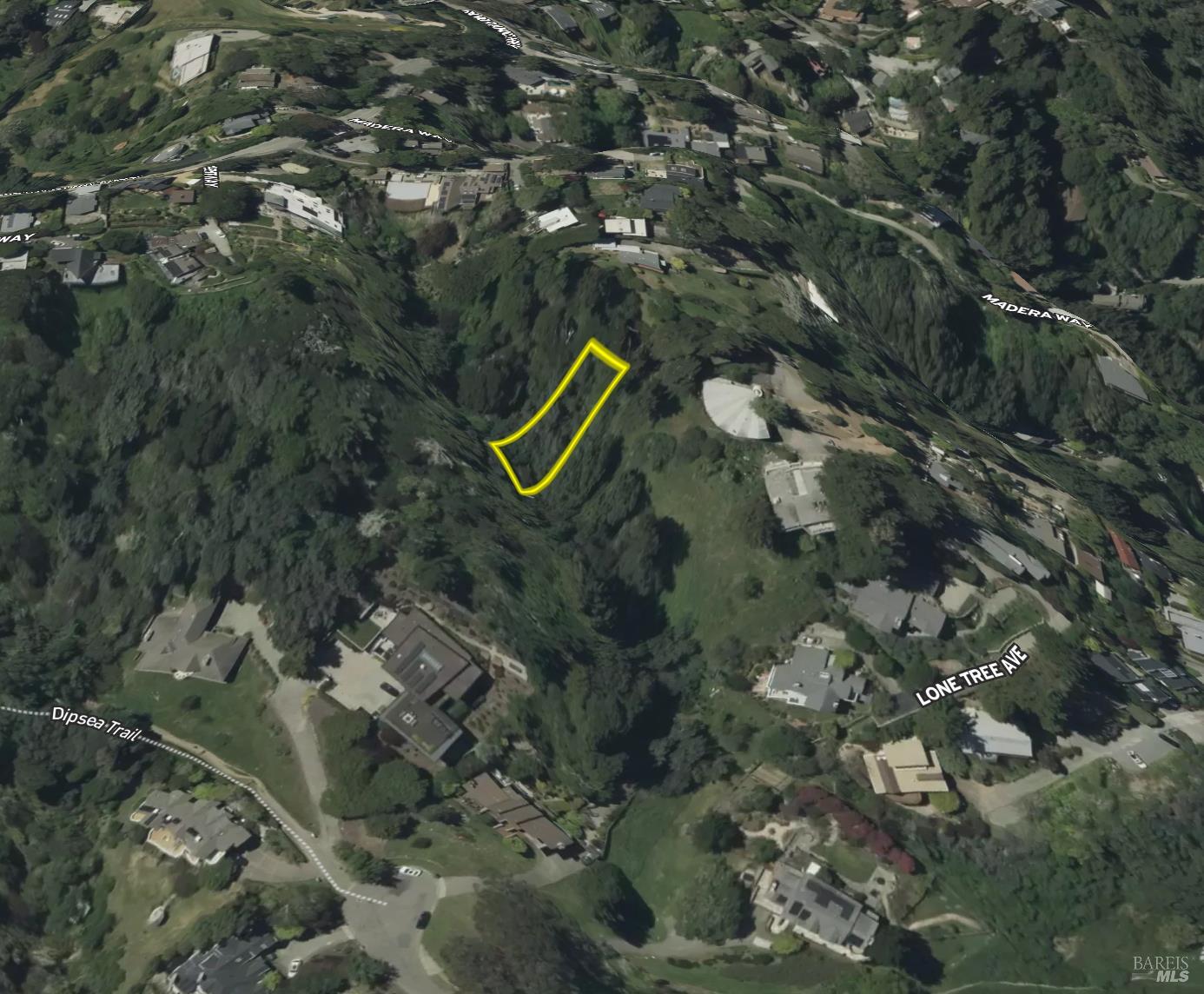
This image displays the subject property, outlined in yellow, surrounded by a landscape of rolling hills and mature trees. Adjacent parcels are delineated by property lines, and several homes are visible on the surrounding slopes.
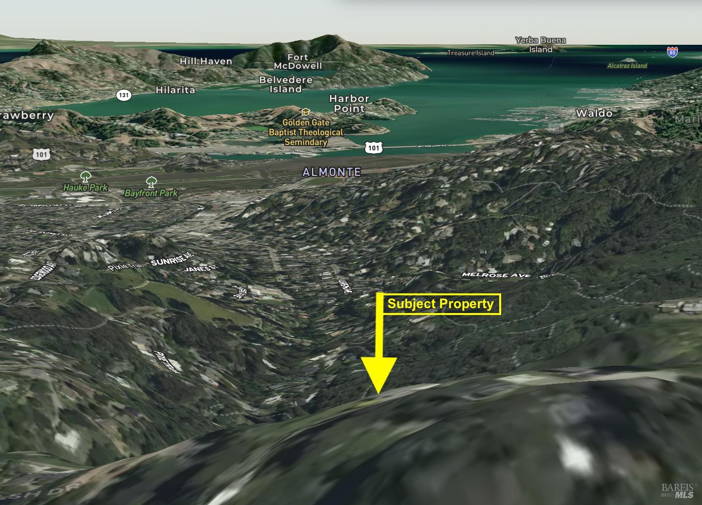
This elevated view positions the subject property in the foreground, with a broad vista of the surrounding geographical features. Distant landmarks like Mount Tamalpais and bodies of water such as the San Francisco Bay are visible, offering a sense of the area's topography.
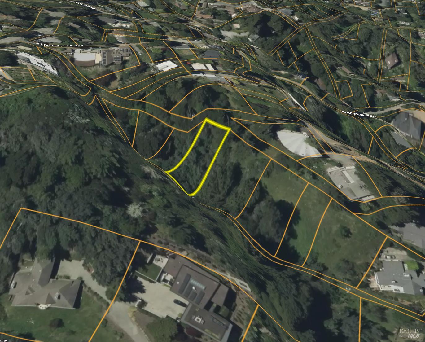
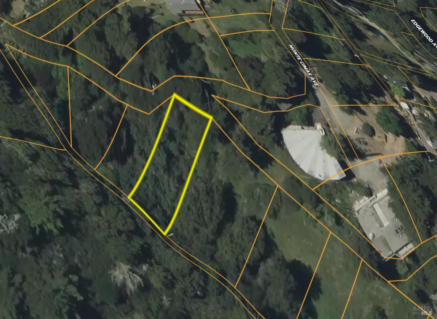
This close-up aerial view shows the subject property, outlined in yellow, with clear property lines visible in orange. The terrain is moderately wooded, with a few cleared areas and residential structures nearby.
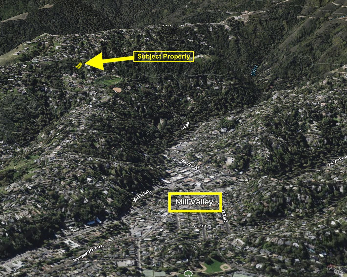
This aerial view places the subject property within a wider context of a valley community, with Mill Valley labeled below. The property is situated on a mountainous incline, densely covered in trees, with a network of roads visible throughout the area.
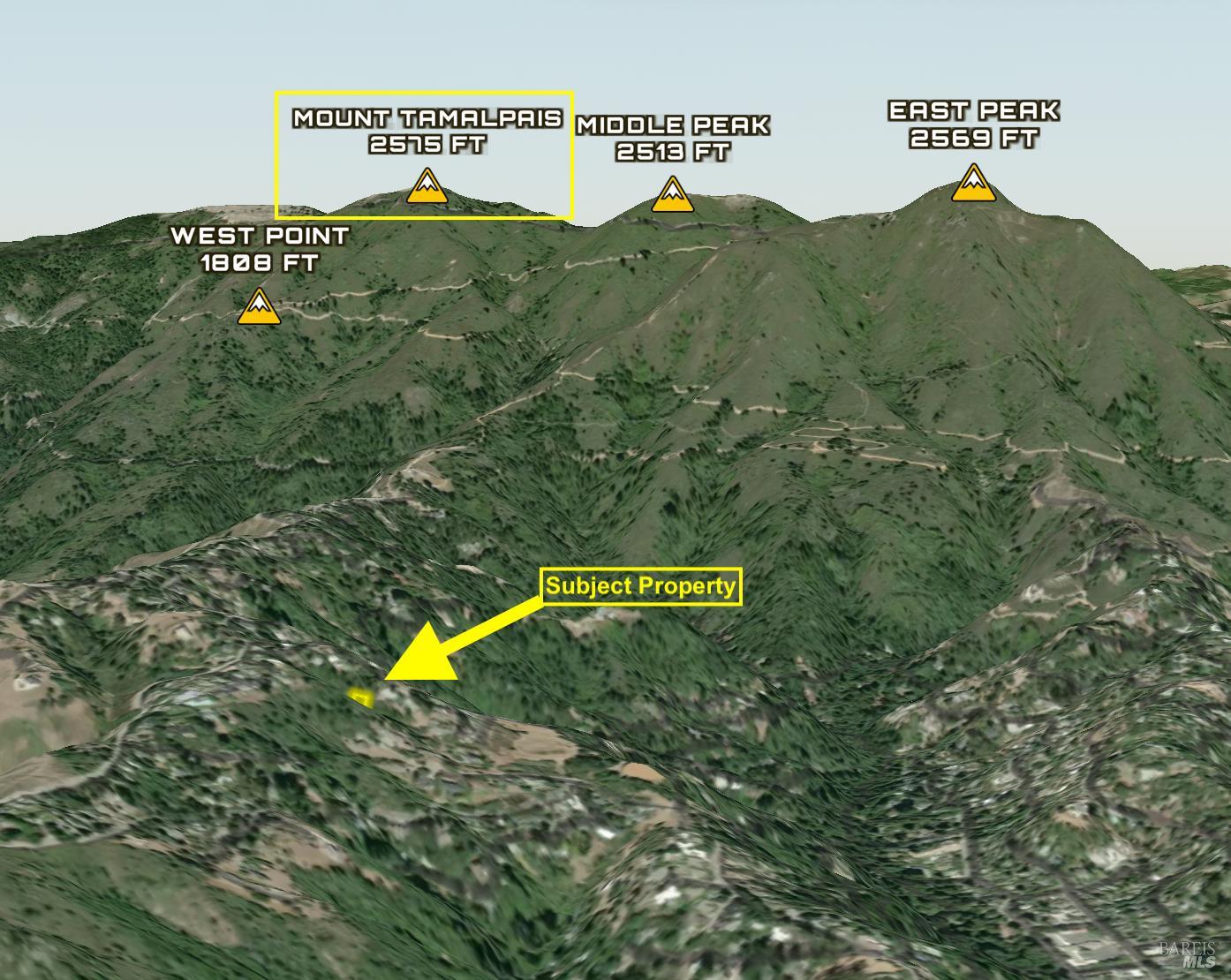
This distant aerial view situates the subject property in the lower portion of the frame, with the imposing peaks of Mount Tamalpais dominating the background. The surrounding terrain is rugged and mountainous, with winding roads visible on the slopes.
Embedding Input Text
Monte Cimas Avenue, Mill Valley, CA 94941. 5,248 sqft lot. Land. Nearest freeway: Redwood Highway (2.5 mi). The property is situated on a sloping lot, appearing larger than immediately adjacent neighboring properties which are also surrounded by dense vegetation. To the north, the property is bordered by a gravel driveway and other residential structures, while to the east and south, it backs onto an undeveloped, tree-covered hillside. The backyard features a prominent swimming pool, paved patio areas, and significant landscaping with mature trees. The lot is accessed by a winding street that appears to be a through street rather than a cul-de-sac, with the neighborhood having a moderately spaced density.. This aerial view shows a wooded parcel of land outlined in yellow, situated on a steep, natural slope. The surrounding terrain is characterized by dense foliage and undulations in the earth.. This aerial perspective highlights the subject property, outlined in yellow, nestled within a hillside community with numerous residential structures visible. Roadways such as Panoramic Highway and Kent Way are labeled, indicating the location's accessibility.. This image displays the subject property, outlined in yellow, surrounded by a landscape of rolling hills and mature trees. Adjacent parcels are delineated by property lines, and several homes are visible on the surrounding slopes.. This elevated view positions the subject property in the foreground, with a broad vista of the surrounding geographical features. Distant landmarks like Mount Tamalpais and bodies of water such as the San Francisco Bay are visible, offering a sense of the area's topography.. This close-up aerial view shows the subject property, outlined in yellow, with clear property lines visible in orange. The terrain is moderately wooded, with a few cleared areas and residential structures nearby.