0 Holstein Road
Property details
Location
View on broker sites
Neighborhood Context
Nearest freeway: Redwood Highway (1.9 mi)
Aerial Description
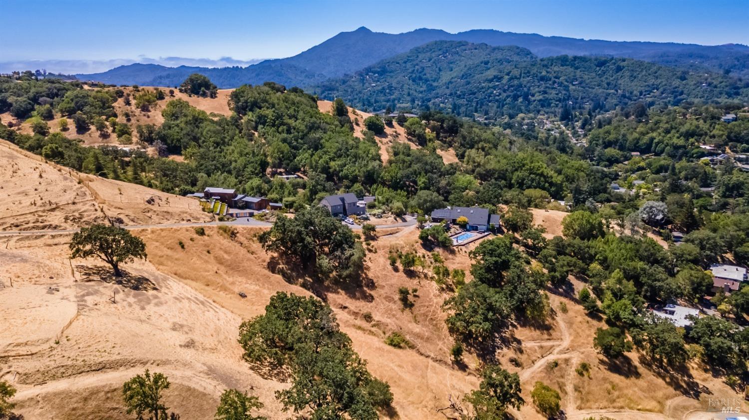
The property is bordered by a road intersection on its west and south sides. To the north, it abuts a large undeveloped grassy area. The east side of the property appears to be adjacent to another residential lot with a swimming pool and patio. The backyard borders an open, grassy space with mature trees. Visible features include a swimming pool, a large patio area, dense vegetation and large trees, and what appears to be a driveway. The lot is irregular in shape and seems to be of average size for the neighborhood, which appears to be moderately dense.
Image Descriptions (5)
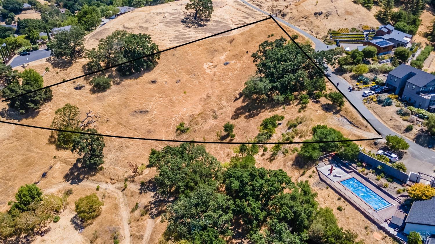
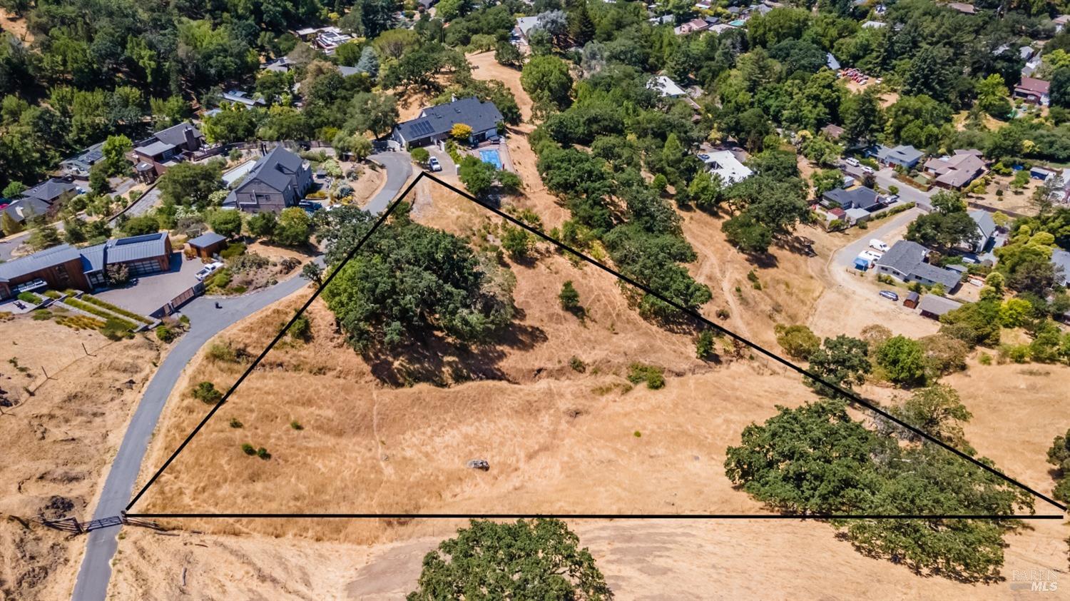
This image offers a similar aerial view with the property boundaries clearly delineated by black lines. A large, rectangular swimming pool with a surrounding deck is prominently featured in the lower right quadrant, adjacent to a modern home. The terrain is characterized by dry vegetation and mature trees, with a winding road providing access to nearby properties.
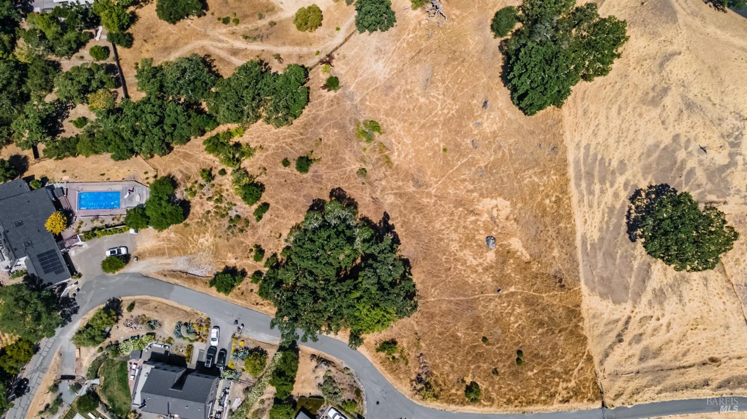
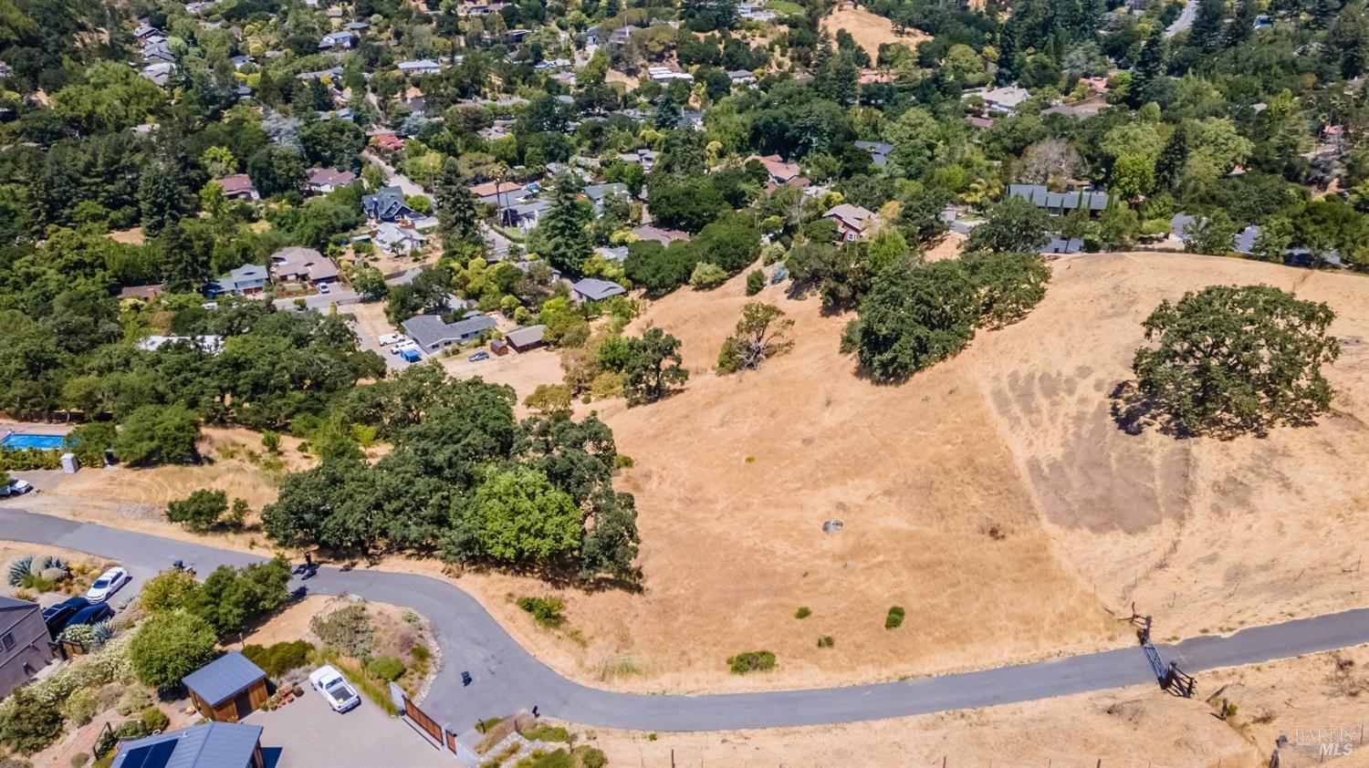
A broad aerial sweep reveals the extensive, dry, and undulating terrain of the property, dotted with significant oak trees. A swimming pool and contemporary residences are visible on the western edge of the aerial view, along with a paved access road. The surrounding landscape is characterized by its natural, undeveloped qualities and hilly contours.
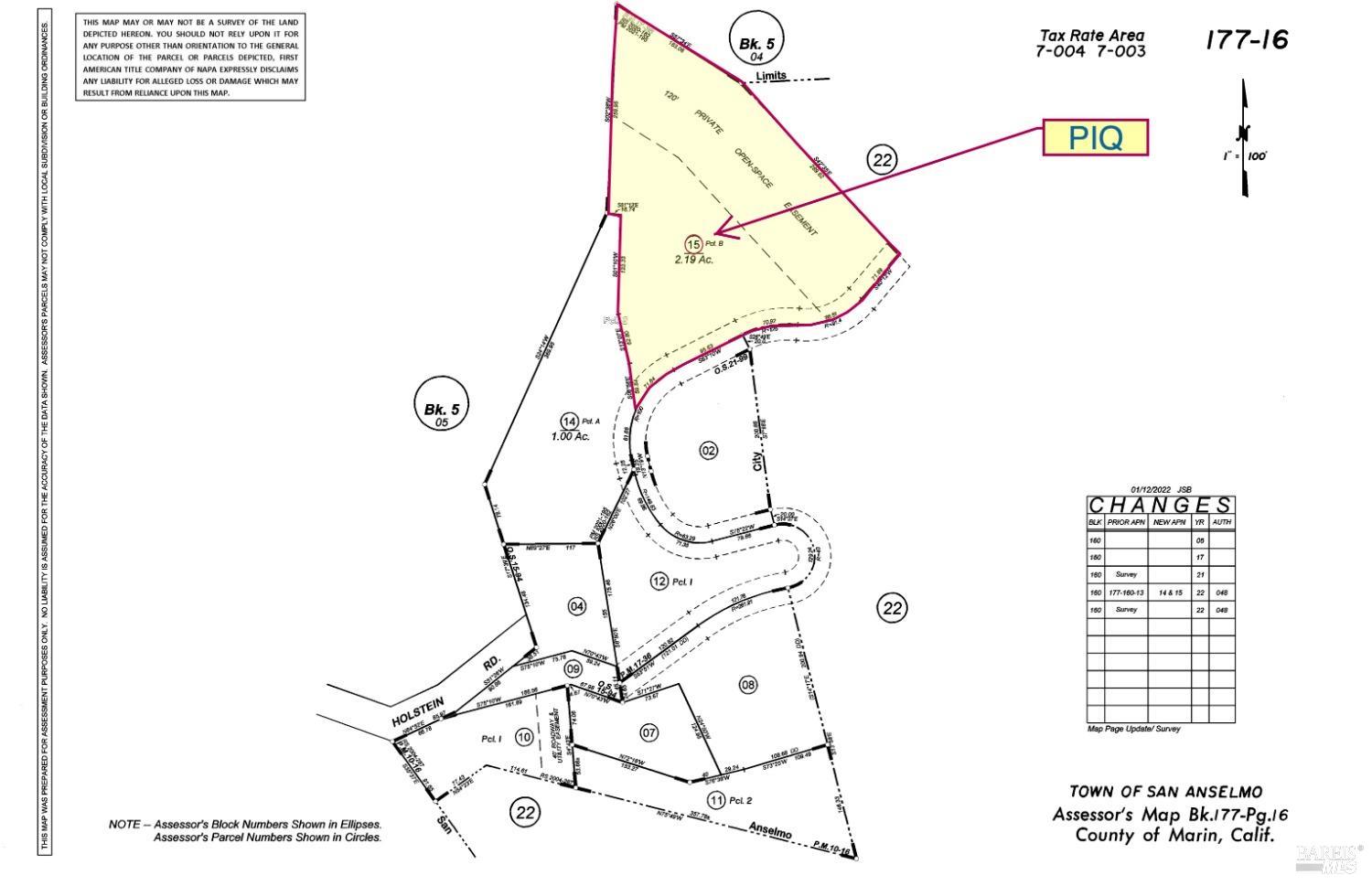
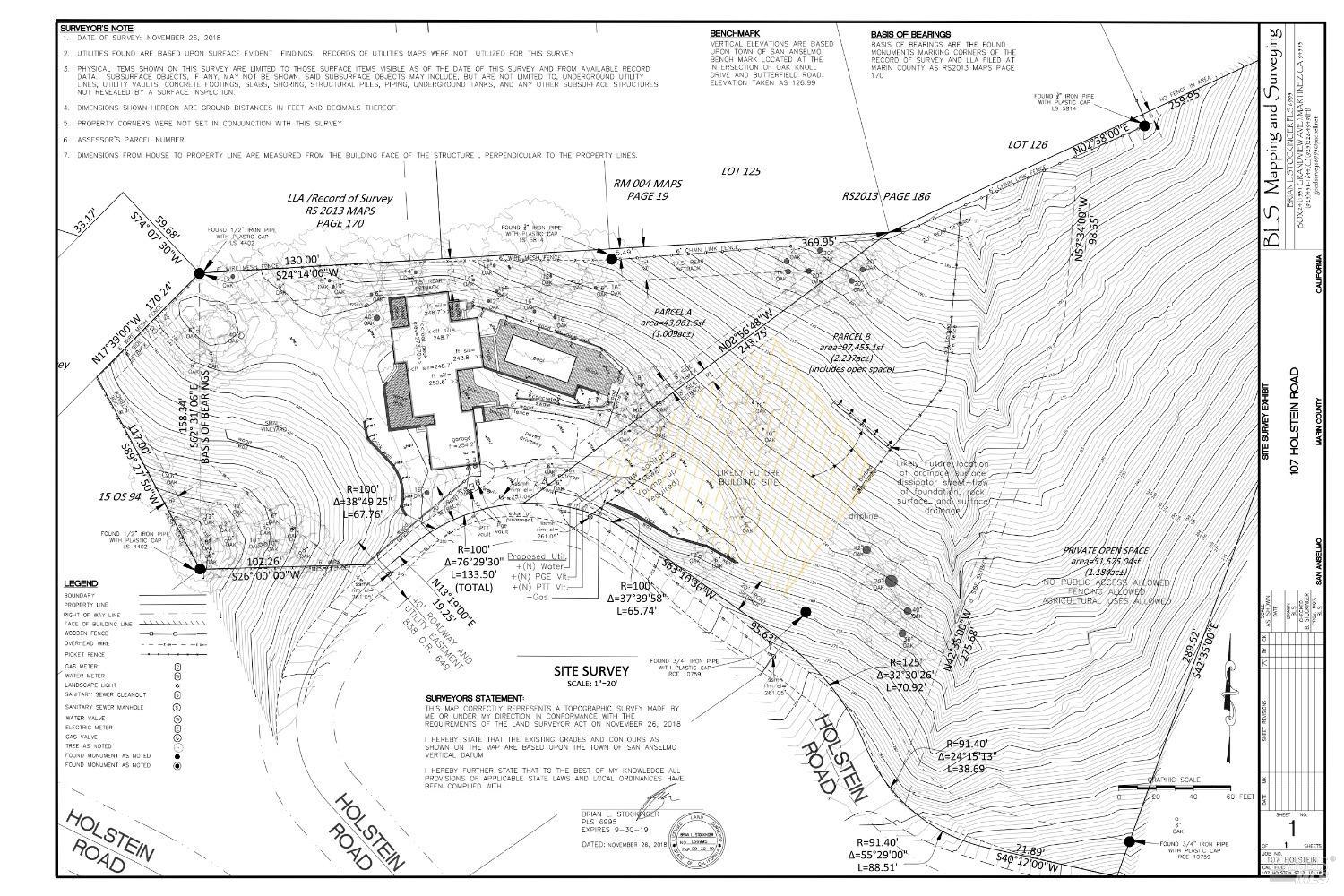
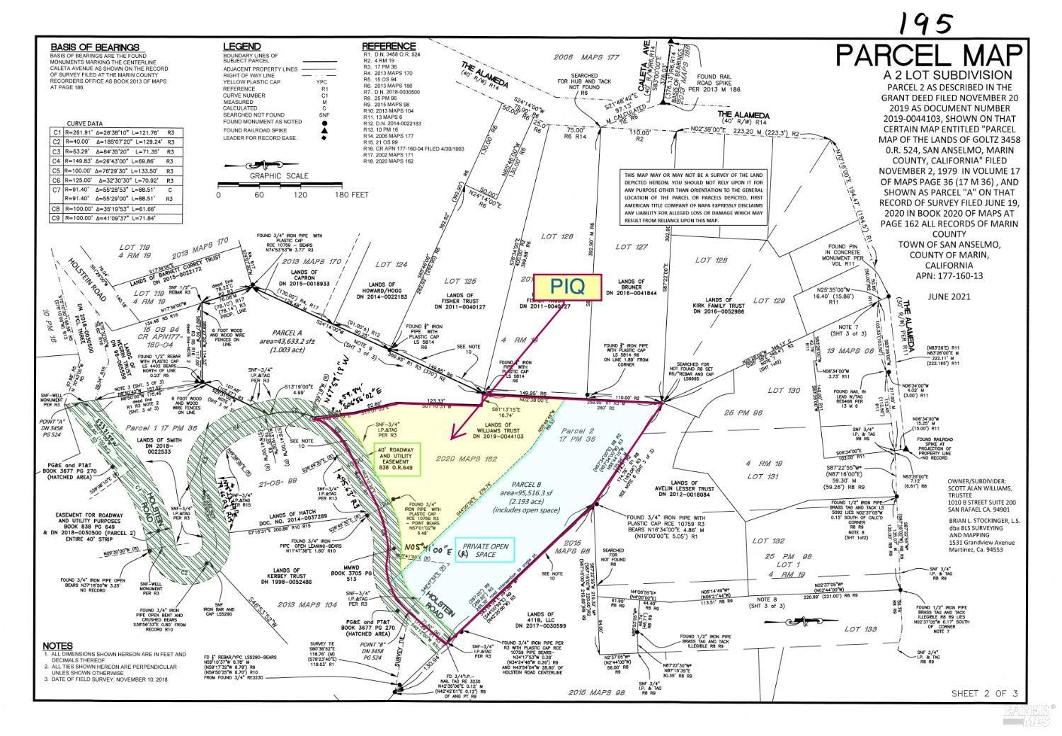
This is a cadastral map detailing property lines, parcel numbers, and lot sizes within a subdivision. It identifies a specific parcel highlighted in yellow, labeled "2.19 Ac." The map also indicates surrounding roads, block numbers, and tax rate area information, providing a technical overview of the land's legal description and surrounding plots.
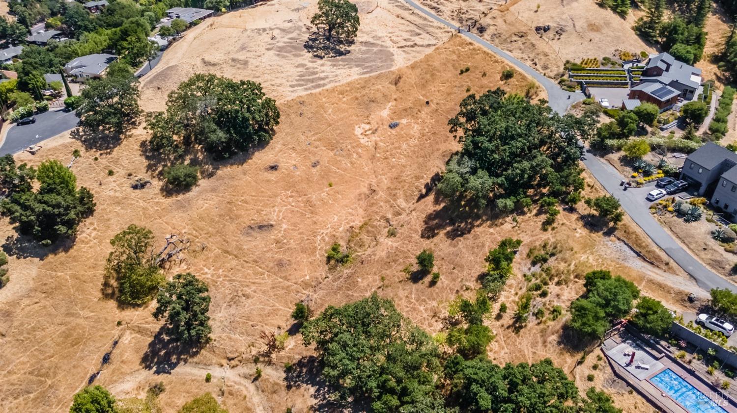
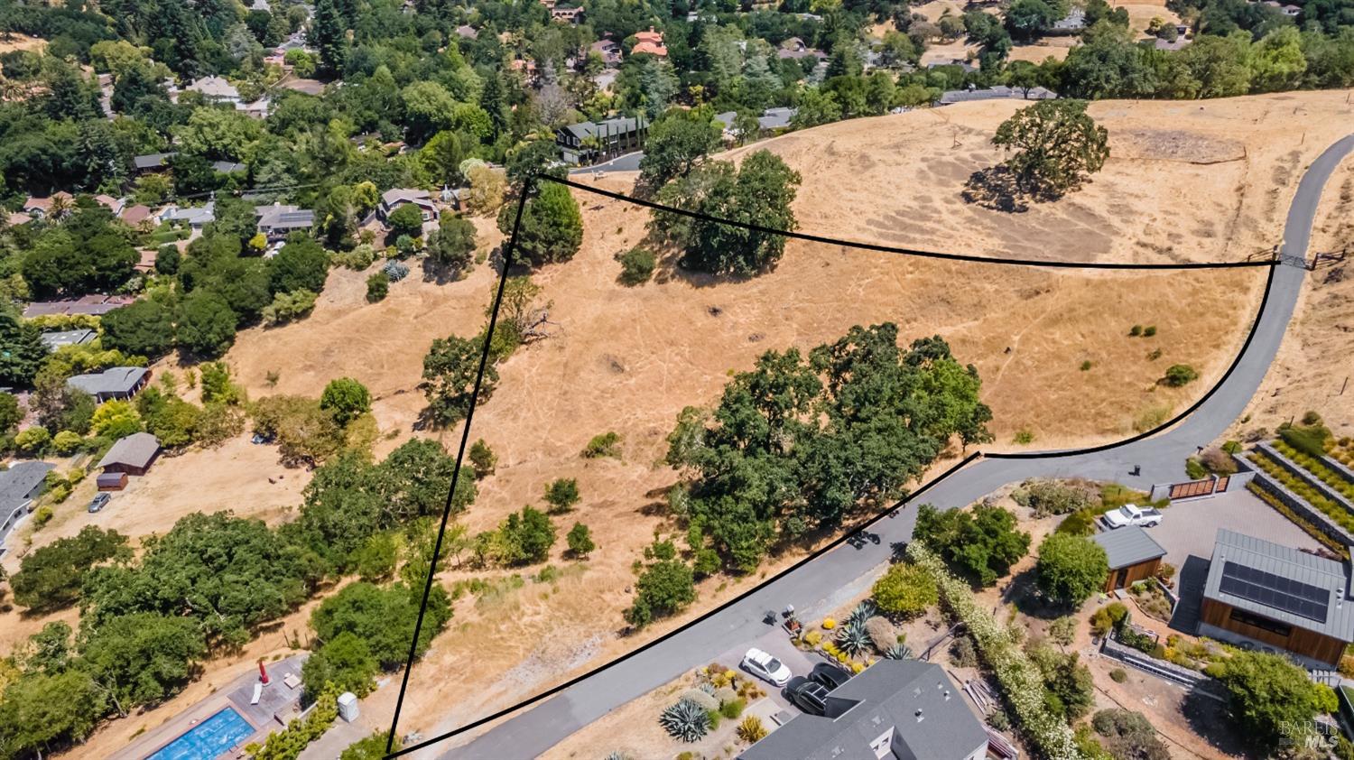
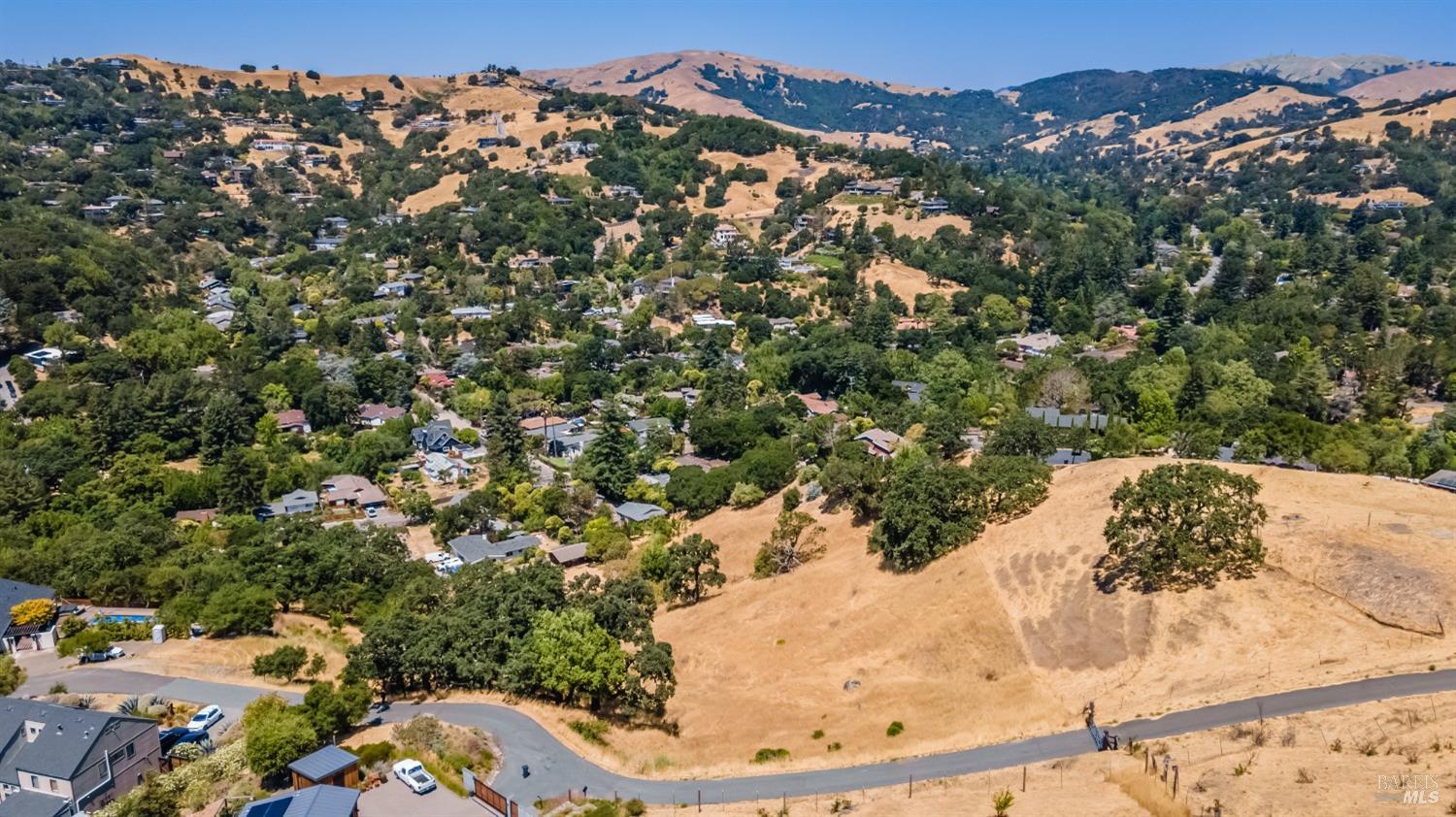
This aerial view showcases a large, undeveloped parcel of land with rolling terrain and scattered mature oak trees. The ground cover is primarily dry grass, suggesting a natural, arid landscape. Several neighboring residences and a prominent swimming pool area are visible in the background, hinting at a suburban or semi-rural setting.
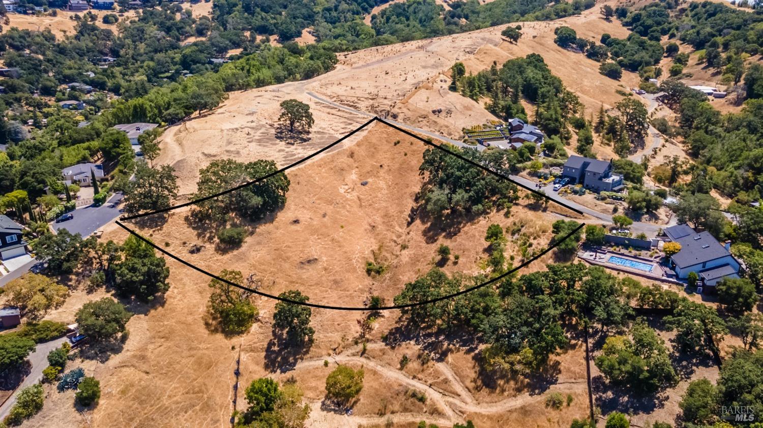
An expanded aerial perspective outlines the boundaries of the subject property, highlighting its irregular shape and significant acreage. Mature trees are interspersed throughout the land, with a visible driveway leading to an adjacent development featuring modern homes and a well-maintained swimming pool. The surrounding topography is hilly, with residential structures built into the landscape.
Embedding Input Text
0 Holstein Road, San Anselmo, CA 94960. 2.19 acre lot. Land. Nearest freeway: Redwood Highway (1.9 mi). The property is bordered by a road intersection on its west and south sides. To the north, it abuts a large undeveloped grassy area. The east side of the property appears to be adjacent to another residential lot with a swimming pool and patio. The backyard borders an open, grassy space with mature trees. Visible features include a swimming pool, a large patio area, dense vegetation and large trees, and what appears to be a driveway. The lot is irregular in shape and seems to be of average size for the neighborhood, which appears to be moderately dense.. This aerial view showcases a large, undeveloped parcel of land with rolling terrain and scattered mature oak trees. The ground cover is primarily dry grass, suggesting a natural, arid landscape. Several neighboring residences and a prominent swimming pool area are visible in the background, hinting at a suburban or semi-rural setting.. This image offers a similar aerial view with the property boundaries clearly delineated by black lines. A large, rectangular swimming pool with a surrounding deck is prominently featured in the lower right quadrant, adjacent to a modern home. The terrain is characterized by dry vegetation and mature trees, with a winding road providing access to nearby properties.. A broad aerial sweep reveals the extensive, dry, and undulating terrain of the property, dotted with significant oak trees. A swimming pool and contemporary residences are visible on the western edge of the aerial view, along with a paved access road. The surrounding landscape is characterized by its natural, undeveloped qualities and hilly contours.. This is a cadastral map detailing property lines, parcel numbers, and lot sizes within a subdivision. It identifies a specific parcel highlighted in yellow, labeled "2.19 Ac." The map also indicates surrounding roads, block numbers, and tax rate area information, providing a technical overview of the land's legal description and surrounding plots.. An expanded aerial perspective outlines the boundaries of the subject property, highlighting its irregular shape and significant acreage. Mature trees are interspersed throughout the land, with a visible driveway leading to an adjacent development featuring modern homes and a well-maintained swimming pool. The surrounding topography is hilly, with residential structures built into the landscape.