Monte Cimas Avenue
Property details
Location
View on broker sites
Neighborhood Context
Nearest freeway: Redwood Highway (2.5 mi)
Aerial Description
The property is situated on a through street with a significant incline. To the north and west, the property is bordered by other residential lots with dense vegetation and mature trees. Directly to the east and south, the property backs onto undeveloped, sloped land with heavy tree cover, appearing to be a natural hillside or undeveloped open space. The lot is substantial and appears larger than its immediate neighbors, featuring a large swimming pool, extensive paved patio areas, and a considerable amount of dense vegetation and large trees.
Image Descriptions (8)
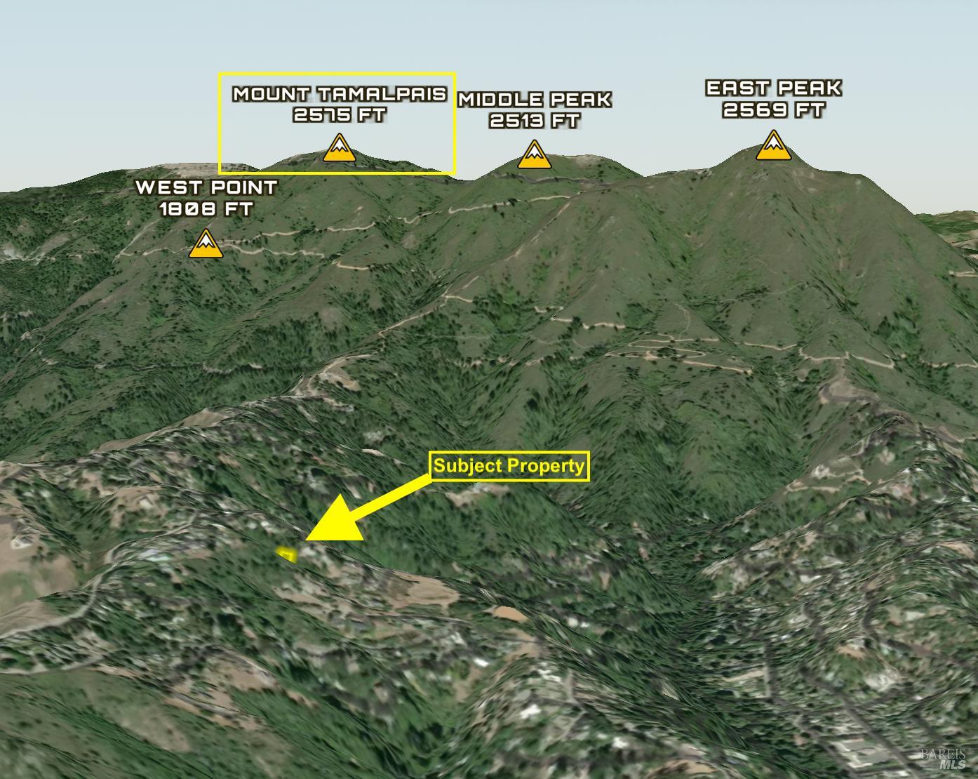
This aerial view shows a mountainous terrain with dense green trees. The subject property is identified with a yellow arrow in a cleared area amidst the hills. Surrounding peaks are labeled, indicating significant elevation.
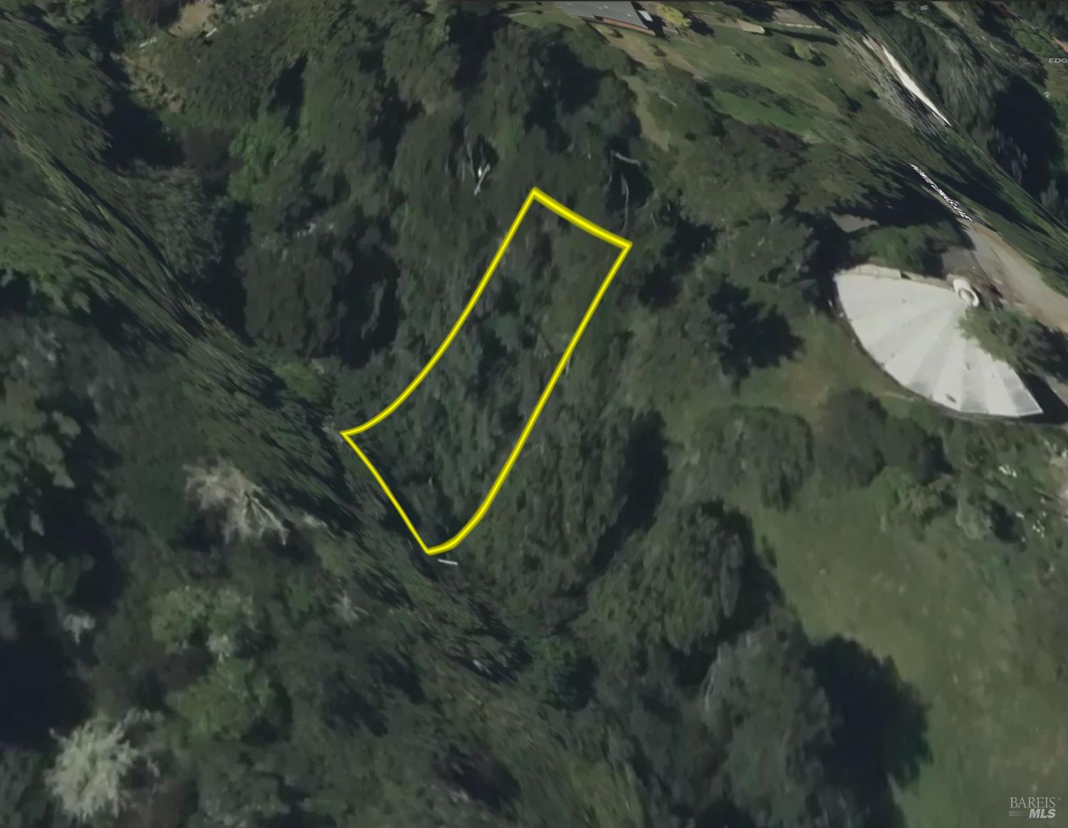
This aerial shot focuses on the subject property, outlined in yellow, nestled within a steep, tree-covered hillside. A large, circular paved area is visible to the right of the property boundary. The terrain suggests a remote, natural setting.
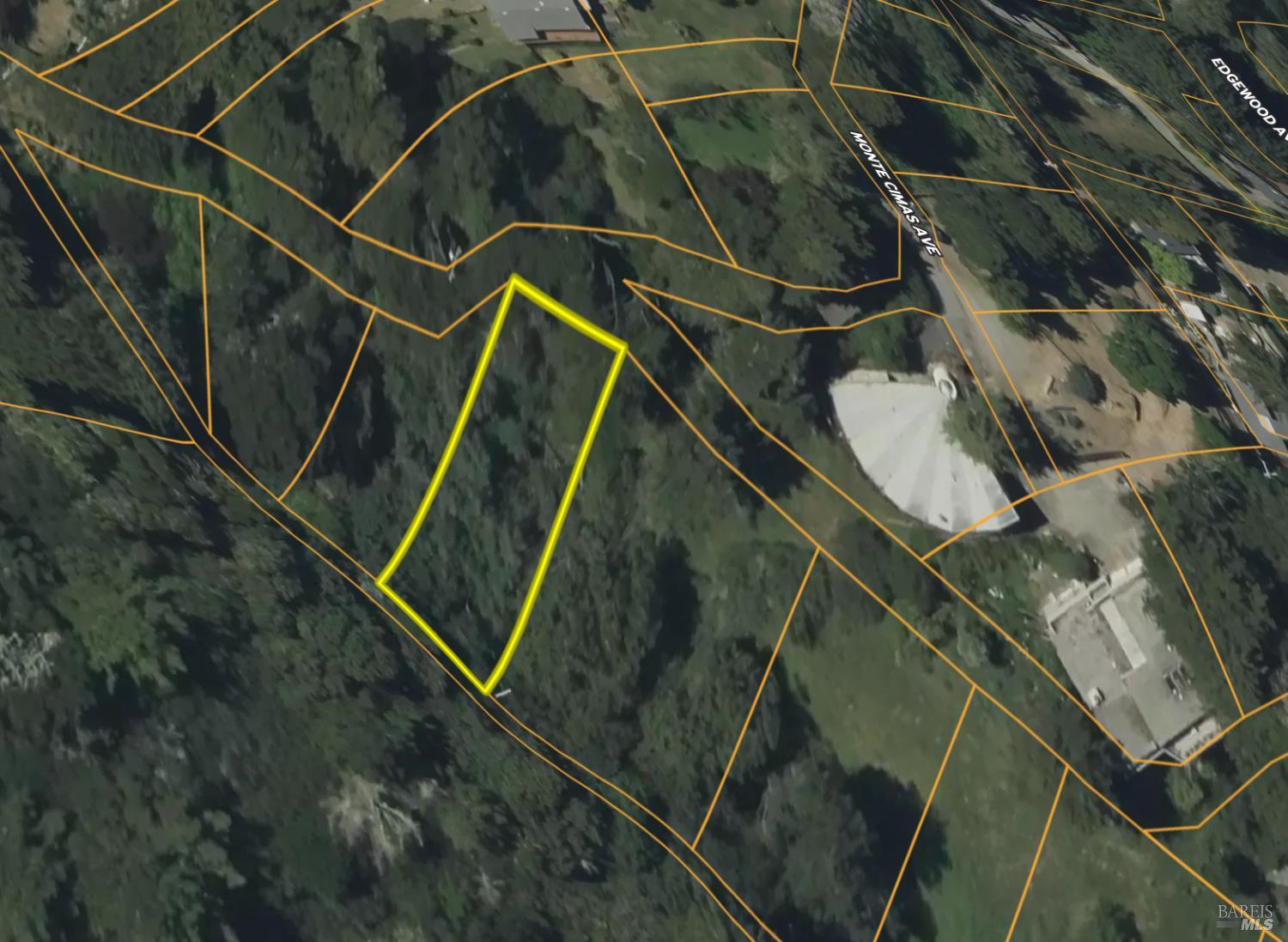
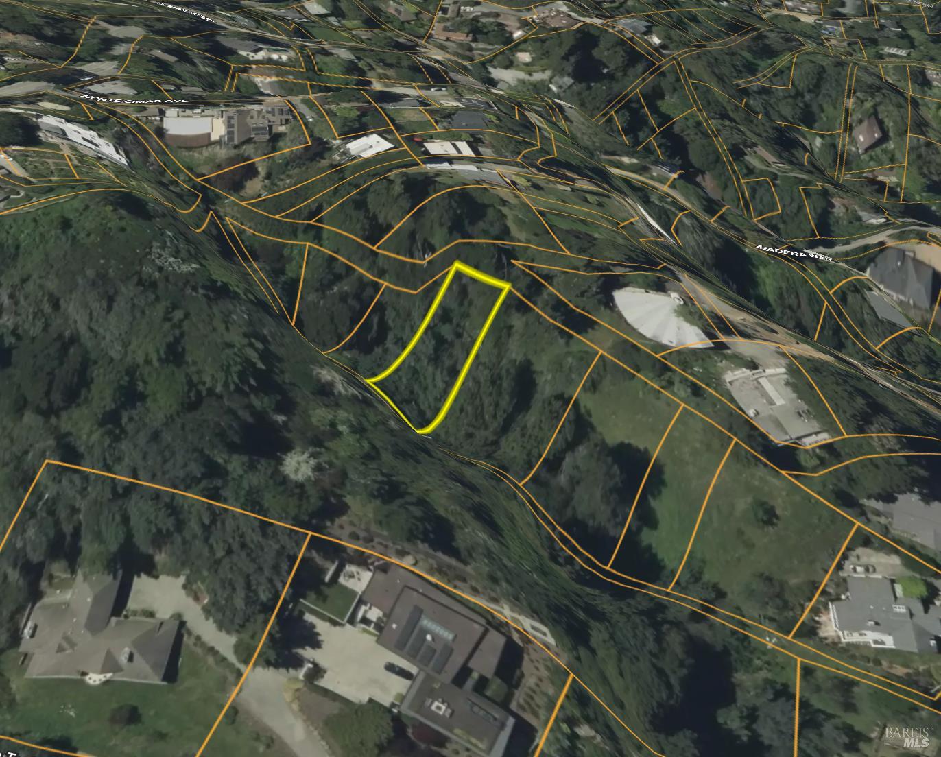
This aerial image presents the subject property outlined in yellow, with property lines delineated by orange markings. Roads named "MONTEOMAS AVE" and "EDGEWOOD AVE" are visible, along with adjacent parcels. A large, circular concrete structure is situated to the right of the property.
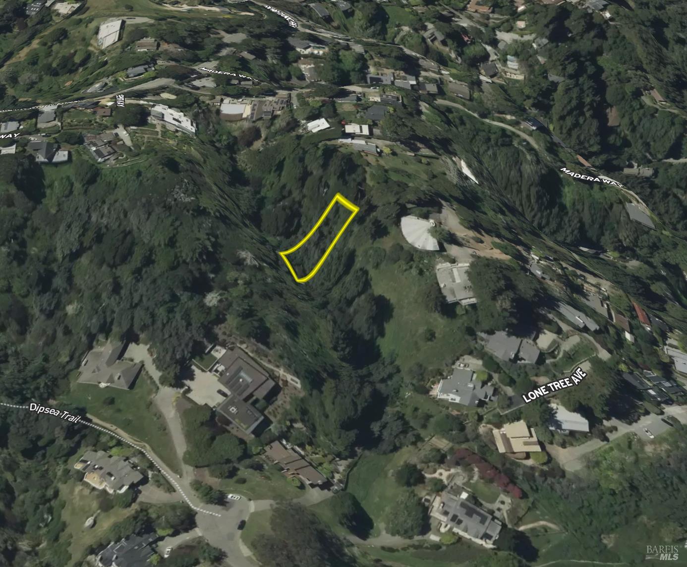
This elevated aerial view displays the subject property outlined in yellow, surrounded by dense foliage. Numerous residences are visible on the slopes and in the surrounding valleys. Roads such as "MADERA WEST" and "LONE TREE AVE" are identified, indicating a developed, albeit hilly, neighborhood.
This overhead perspective shows the subject property outlined in yellow, set within a densely wooded hillside. Surrounding property lines are clearly marked in orange. The topography is characterized by steep slopes and natural vegetation.
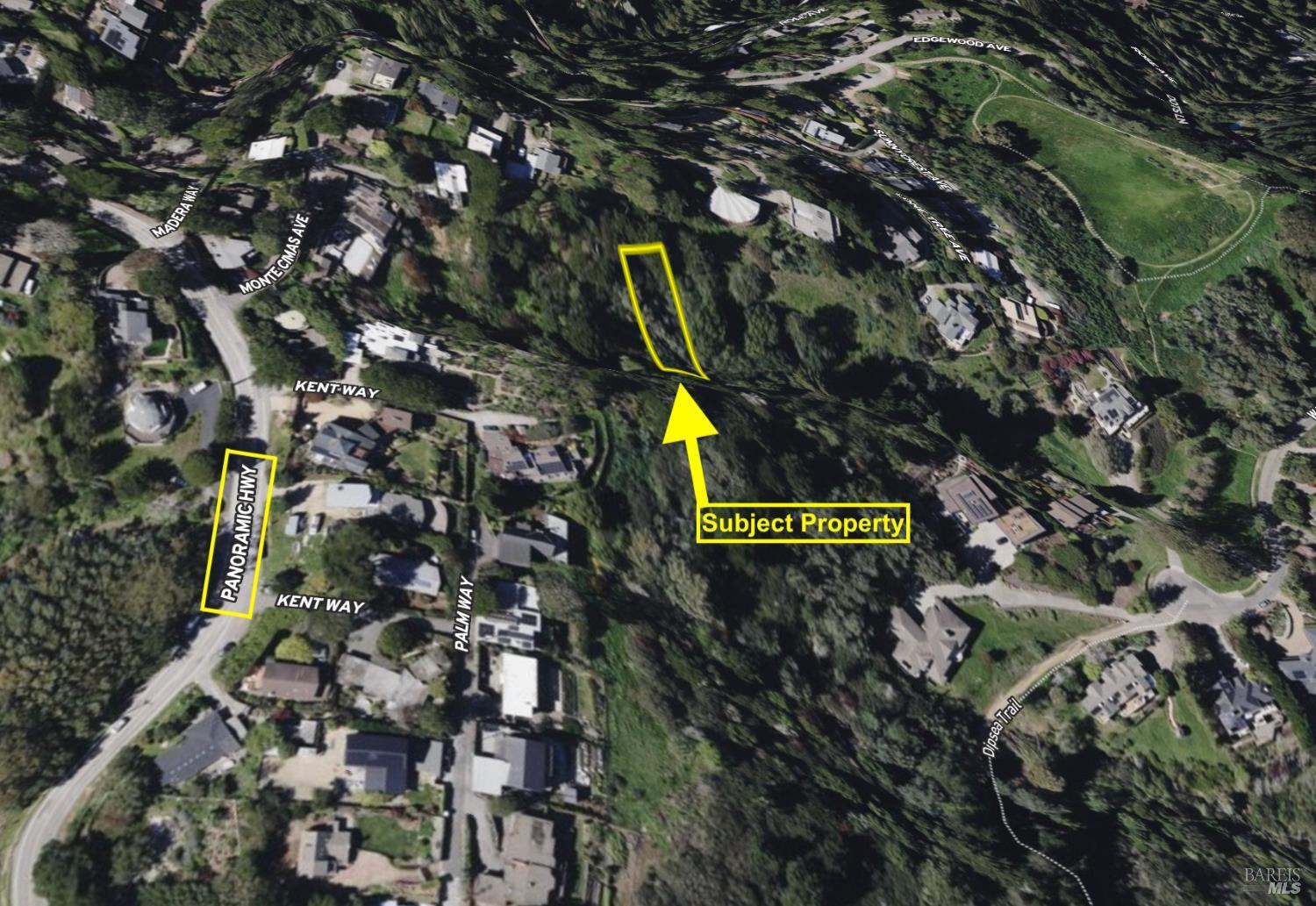
This detailed aerial map labels streets including "PANORAMIC HWY," "KENT WAY," and "MONTEOMAS AVE" near the subject property, which is highlighted in yellow. Residential structures are scattered across the hillside landscape. A prominent feature labeled "THE DOMES" is visible to the west.
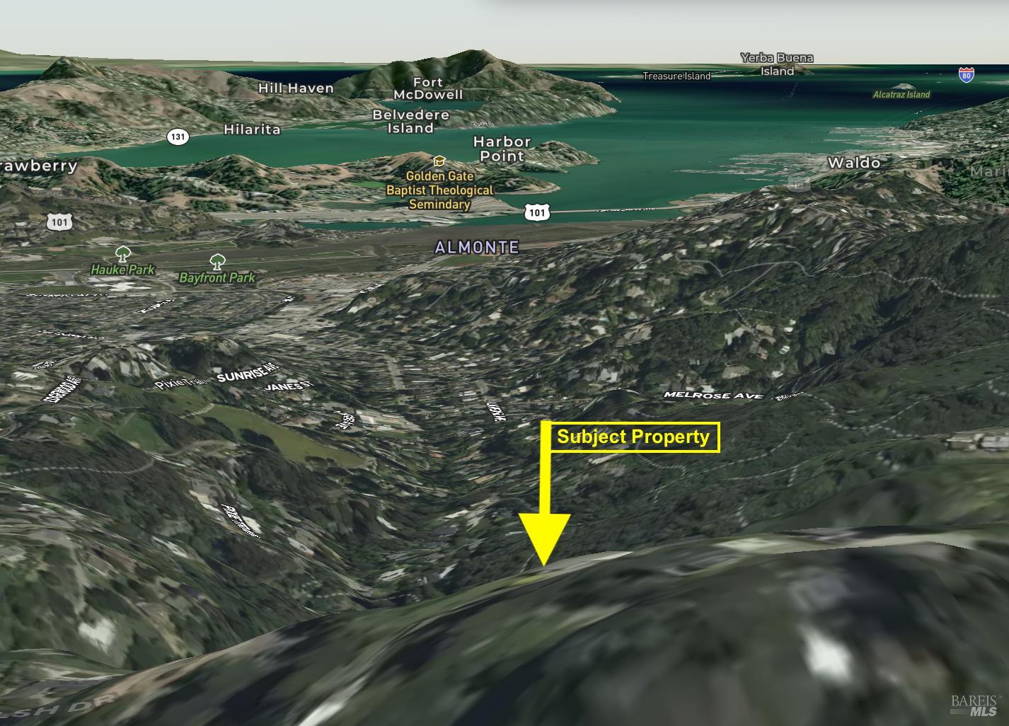
This distant aerial perspective shows the subject property indicated by a yellow arrow, situated on a high ridge overlooking a bay and surrounding communities. Labelled areas include "ALMONTE," "WALDO," and various islands. The terrain is mountainous with significant bodies of water in the distance.
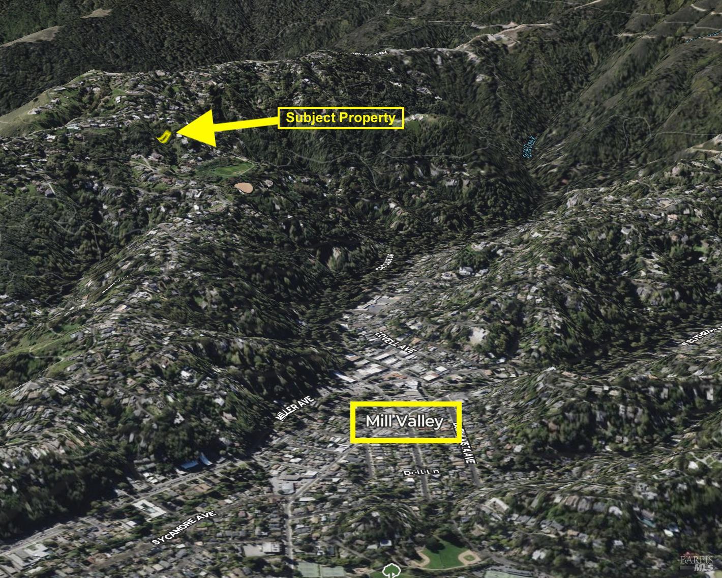
This wide aerial view positions the subject property, indicated by a yellow arrow, within a vast expanse of rolling, tree-covered hills. The urban center of "Mill Valley" is clearly marked in the valley below, providing a sense of scale and location. The landscape is predominantly natural and undeveloped around the subject property.
Embedding Input Text
Monte Cimas Avenue, Mill Valley, CA 94941. 5,248 sqft lot. Land. Nearest freeway: Redwood Highway (2.5 mi). The property is situated on a through street with a significant incline. To the north and west, the property is bordered by other residential lots with dense vegetation and mature trees. Directly to the east and south, the property backs onto undeveloped, sloped land with heavy tree cover, appearing to be a natural hillside or undeveloped open space. The lot is substantial and appears larger than its immediate neighbors, featuring a large swimming pool, extensive paved patio areas, and a considerable amount of dense vegetation and large trees.. This aerial view shows a mountainous terrain with dense green trees. The subject property is identified with a yellow arrow in a cleared area amidst the hills. Surrounding peaks are labeled, indicating significant elevation.. This aerial shot focuses on the subject property, outlined in yellow, nestled within a steep, tree-covered hillside. A large, circular paved area is visible to the right of the property boundary. The terrain suggests a remote, natural setting.. This aerial image presents the subject property outlined in yellow, with property lines delineated by orange markings. Roads named "MONTEOMAS AVE" and "EDGEWOOD AVE" are visible, along with adjacent parcels. A large, circular concrete structure is situated to the right of the property.. This elevated aerial view displays the subject property outlined in yellow, surrounded by dense foliage. Numerous residences are visible on the slopes and in the surrounding valleys. Roads such as "MADERA WEST" and "LONE TREE AVE" are identified, indicating a developed, albeit hilly, neighborhood.. This overhead perspective shows the subject property outlined in yellow, set within a densely wooded hillside. Surrounding property lines are clearly marked in orange. The topography is characterized by steep slopes and natural vegetation.